
Recent SIR-C Images of Volcanoes
(processed by Peter Mouginis-Mark)
Recent SIR-C Images of Volcanoes
(processed by Peter Mouginis-Mark)
Kliuchevskoi (K), Kamchatka was vigorously erupting during the October shuttle mission. This is an X-band (3 cm) image, taken late in the eruption on October 4th, and was expected to show the eruption plume. However, to date, no obvious signs that the radar can be used to study eruption plumes have been seen. Bezymianny (B) volcano is also visible in this scene.
As reported in the last issue of the HCV Newsletter, the two Space Shuttle Imaging Radar (SIR-C/X-SAR) missions in April and October of 1994 imaged numerous volcanoes around the world. 43 data takes in April and 89 in October were obtained over volcanoes. Many other scenes also included volcanoes by happenstance. Although no complete volcano image list has been compiled, we know that 12 of the 15 Decade volcanoes were imaged, as well as Kliuchevskoi, Rabaul, and in eruption. The following images provide a small sampler.
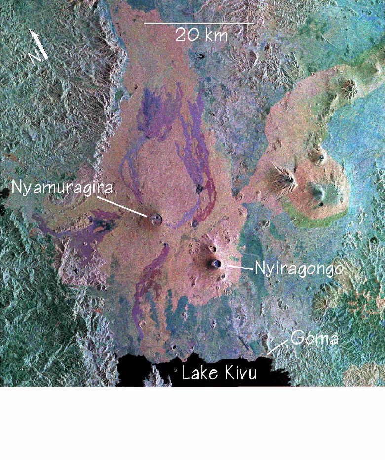 Nyiragongo (lower right) and Nyamuragira (center). Lava flows of Nyamuragira
stand out in contrast to the bright background of vegetation. Compare to the
sketch map in the previous article.
Nyiragongo (lower right) and Nyamuragira (center). Lava flows of Nyamuragira
stand out in contrast to the bright background of vegetation. Compare to the
sketch map in the previous article.
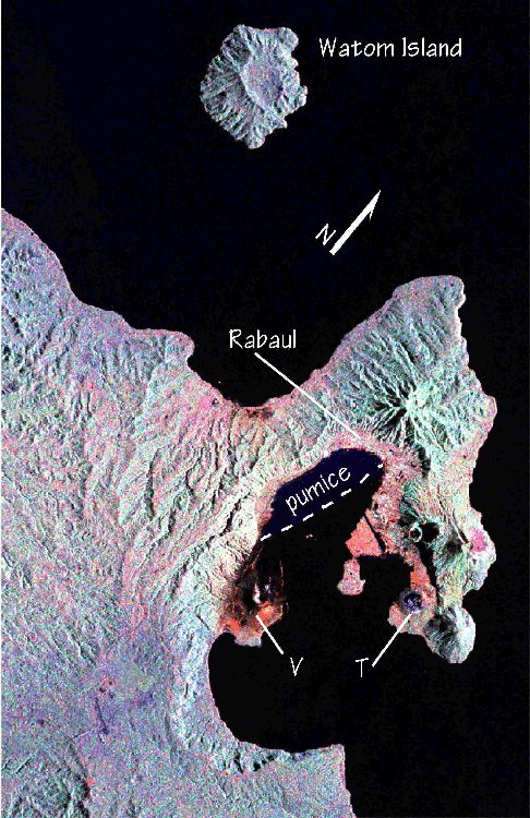
Rabaul, Papua New Guinea: This image was taken October 8th, soon after the main 1994 eruptions at Vulcan (V) and Tavurvur (T). Radar topographic data for Rabaul have yet to be processed, but may offer new insights to the eruption.
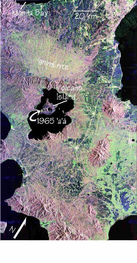 Taal, central Luzon, Philippines: About 1/3 of the ~25 km-wide caldera is
occupied by a lake (black), within which sits Volcano Island. The 1965
flow (arrow) is the bright patch at the SW tip of Volcano Island.
Taal, central Luzon, Philippines: About 1/3 of the ~25 km-wide caldera is
occupied by a lake (black), within which sits Volcano Island. The 1965
flow (arrow) is the bright patch at the SW tip of Volcano Island.
reprinted from the Hawaii Center for Volcanology Newsletter, Volume 2, Number 1, December 1994
 Hawaii Center for Volcanology Home Page
This page created and maintained by
Ken Rubin ©,
krubin@soest.hawaii.edu
Other
Last page update on 31 Jan 2002